Green Flag
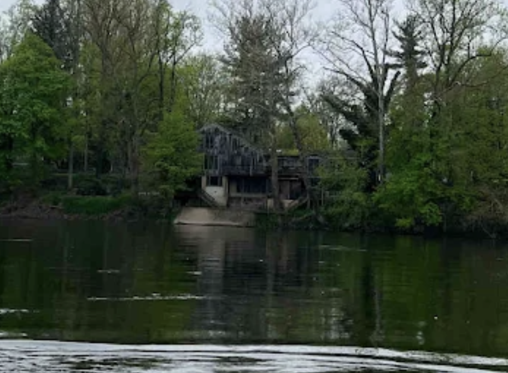
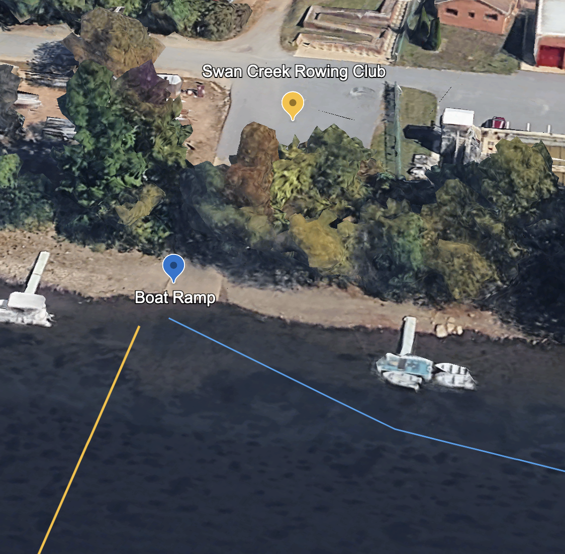
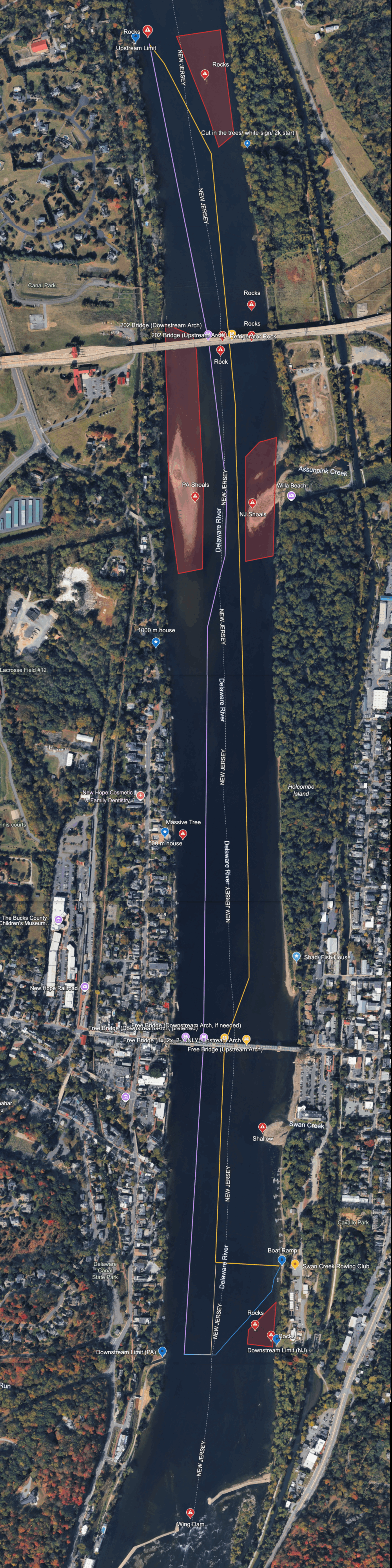
River Navigation
SCRC has a river navigation protocol to ensure safety for its members, assets, and others using the river. Typical navigation is upstream on the New Jersey side and downstream on the Pennsylvania side.
Exercise an abundance of caution when navigating through the Free Bridge and 202 Bridge arches. Click here or keep scrolling to see a depiction of the arches that you should use per the River Navigation map.
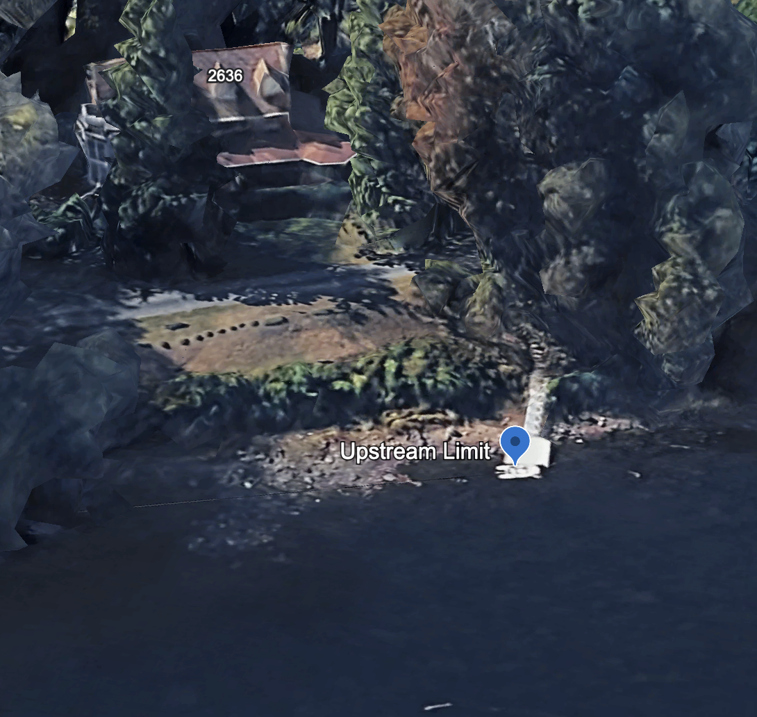
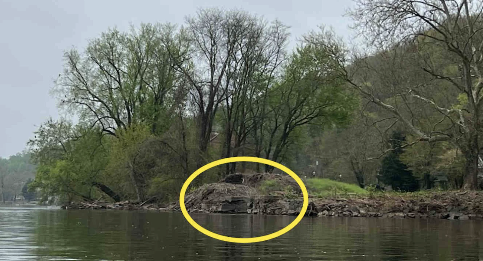
Above the 202 Bridge is rocky on the New Jersey side. Depending on the flow, you may or may not see the rocks. In order to exercise the upmost caution, the river navigation north of the 202 Bridge is on the New Jersey side of the middle, not on the New Jersey bank.
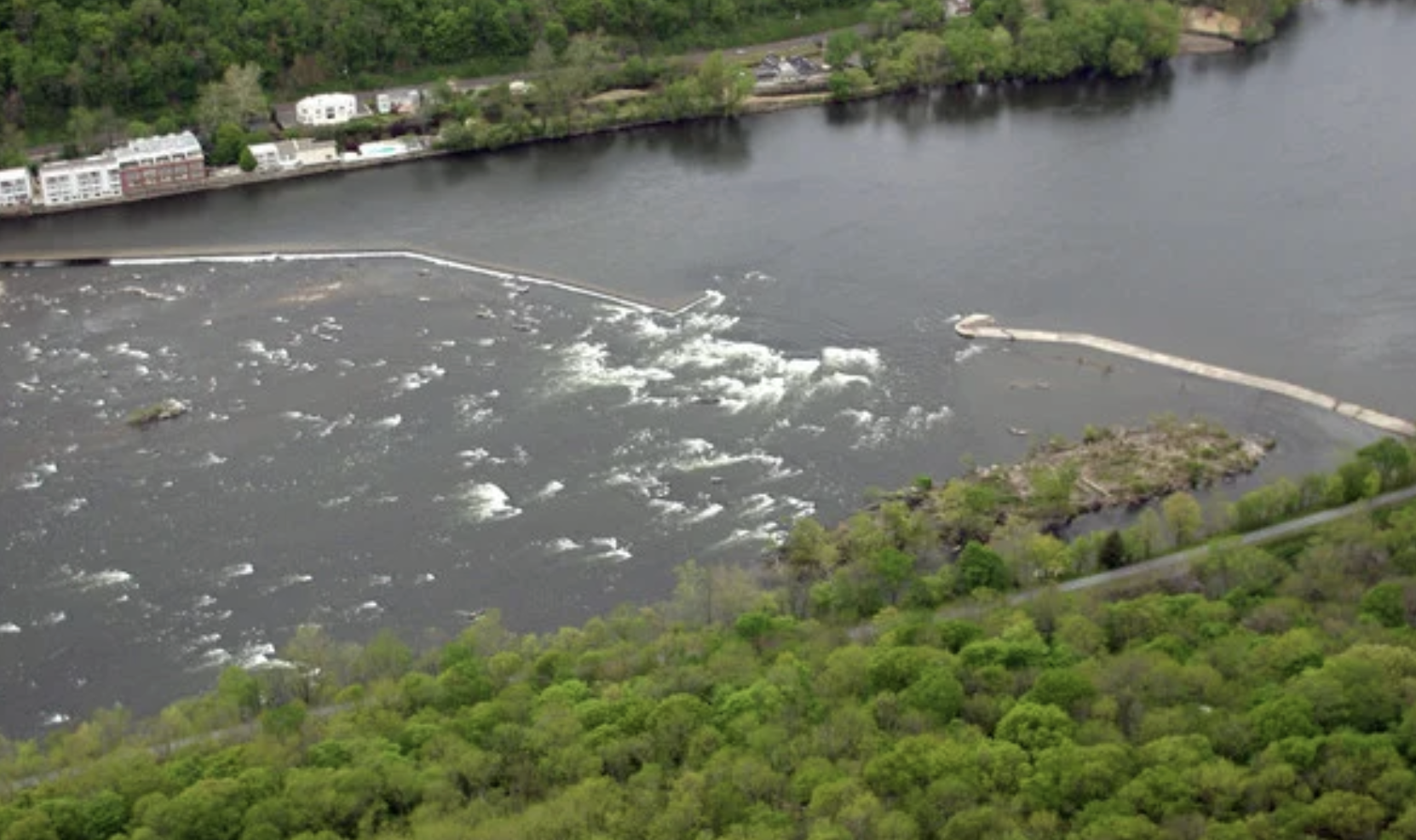
In low water, exercise increased caution for low water hazards – especially through the shoals, bridges and at the ramp. The NJ upstream route through the shoals is deeper and the downstream route through the shoals is in the middle of the river. The PA side through the shoals is very very shallow. No boats should be in this area. When launching and landing at the boat ramp, ensure the boat is in deep enough water to protect the skeg and avoid running aground.
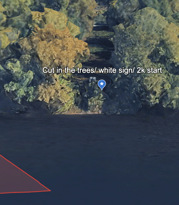
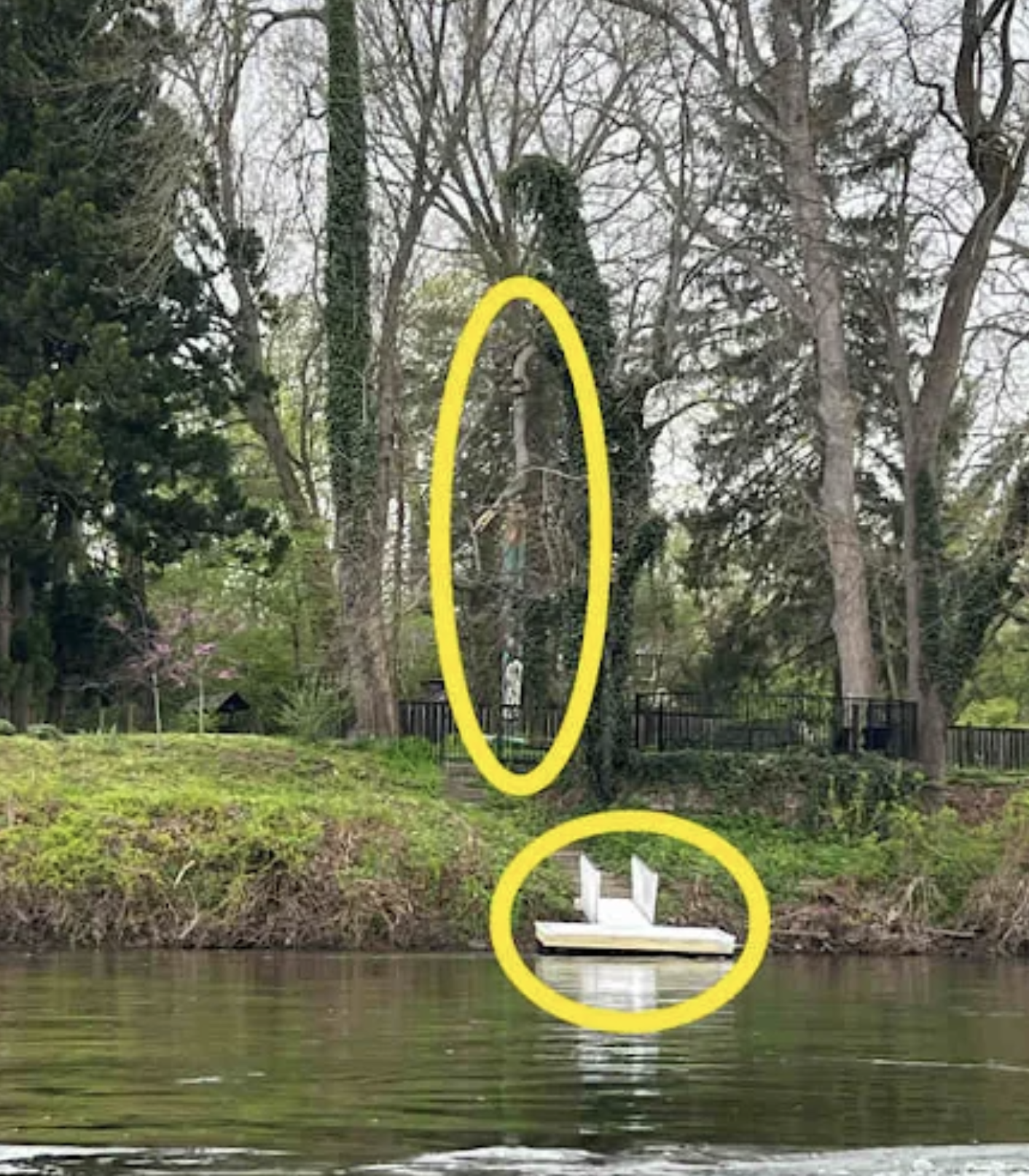
Scroll to the bottom of this page or see the google earth map link for a more interactive view of the river.
The river is always changing. New hazards can appear at any time. And, we share the river with other rowers, fishing boats, dragon boats, kayakers, paddle-boarders, and swimmers. If river traffic is heavy and you cannot go through a designated arch or row your “line,” stop rowing and wait until it is safe to proceed. Exercise caution and common sense.
Bridge Routes
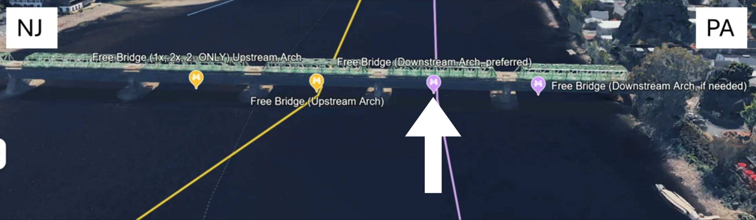
Free Bridge
Free Bridge Upstream Arches
Going upstream, the third arch from PA side is the preferred arch for all boat classes. Alternatively, the fourth arch from PA side can be used for 1x, 2x, 2- boats only. Please exercise caution when going up the fourth arch from PA side as it becomes extremely shallow when there is a brown flag warning.
Preferred route:
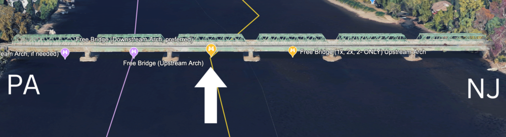
Alternative route (1x, 2x, 2- ONLY):

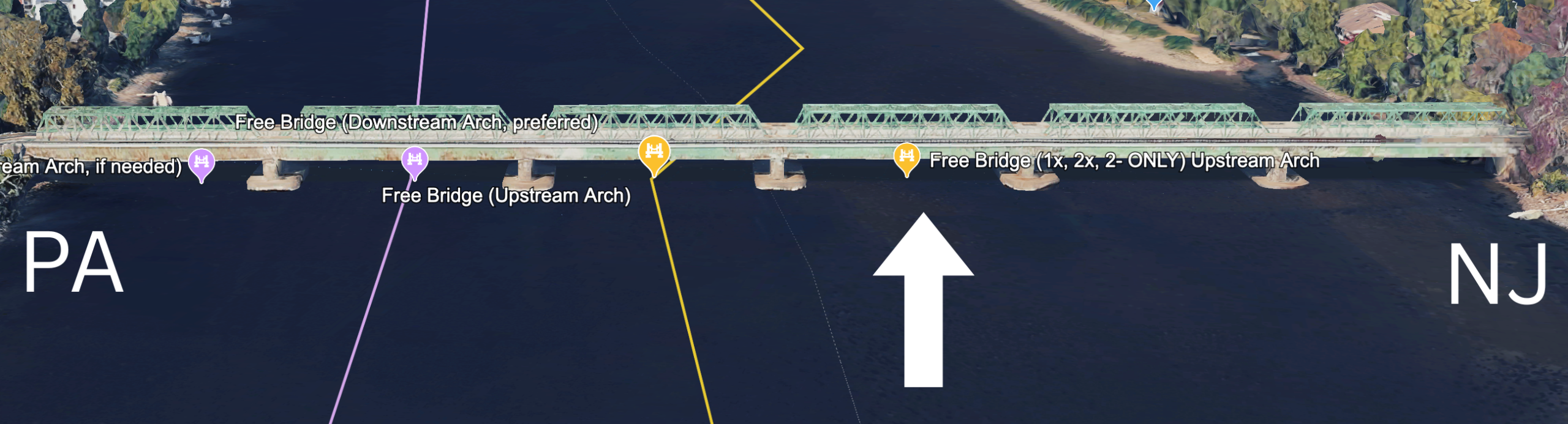
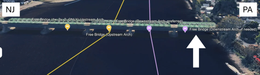
Free Bridge Downstream Arches
Going downstream, the second arch from PA side is preferred. If there is a lot of boat traffic, boats can also go down the first arch from PA side, but must watch out for the dock and the shore. There is more clearance in the second arch from PA side.
Preferred route:

Alternative route:
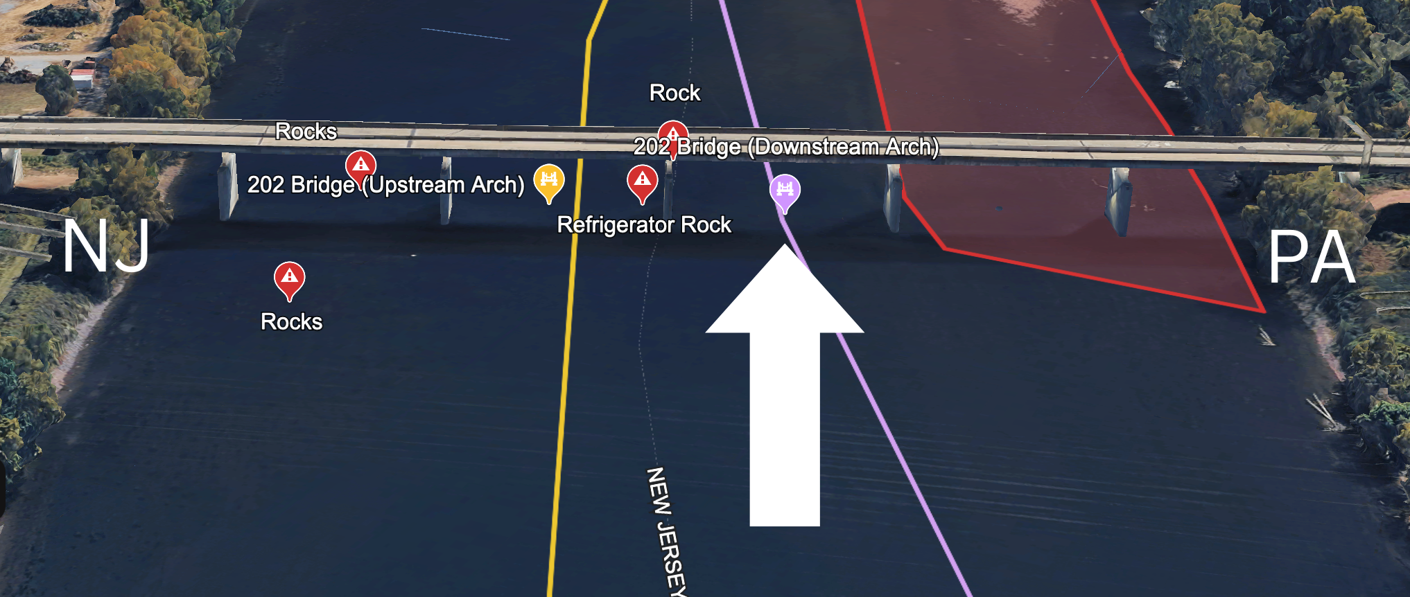
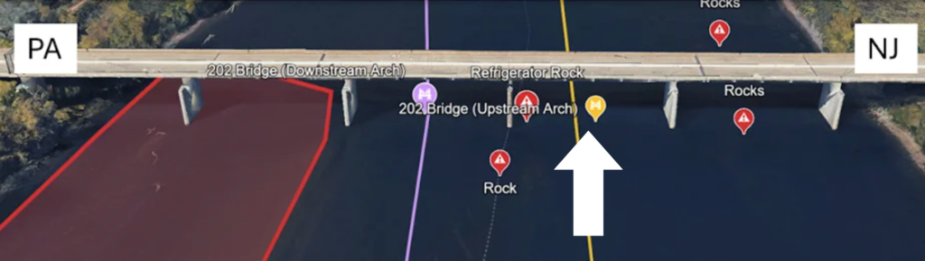
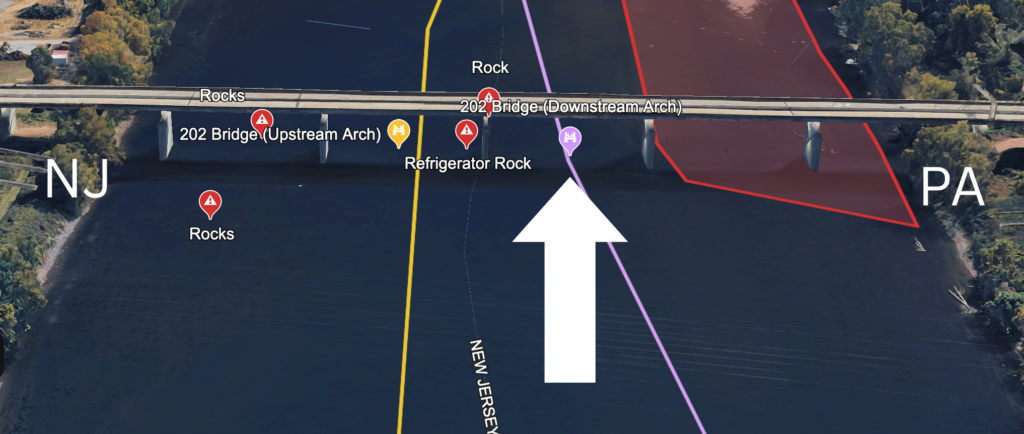
202 Bridge
Going upstream, the fourth arch from PA side is the only acceptable arch. Downstream, the only acceptable arch is the third arch from PA side. The PA side can be extremely shallow especially when there is a brown flag warning.
202 Bridge Upstream Arch
202 Bridge Downstream Arch
Full River Navigation
See below for the full river navigation map. Hover (or click if you are on your phone) over the various landmarks and hazards for more information. The upstream route is yellow and the downstream route is purple. See the google earth map link for a more interactive view of the river.